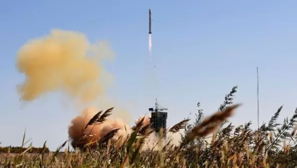
China launches its first forestry satellite
 |
|
China's first forestry satellite successfully launches into space on Jan 9. [Photo/chinajilin.com.cn] |
China's first forestry satellite, which can help improve forestry management level in Jilin province, was successfully launched on Jan 9 from the Jiuquan Satellite Launch Center, located at Inner Mongolia Autonomous Region, according to the Jilin Provincial Forestry Department, and the device has opened a new satellite era for forestry management and research.
Jilin is a forested province with rich resources that cover more than 50 percent of the area. However, its diversified forest types and landforms lead to difficulties in protecting and managing these forestry resources.
"Only by developing the most advanced dynamic remote sensing data can forestry management in Jilin be improved and the rich resources be used well," said Lan Hongliang, director-general of the Jilin Provincial Forestry Department.
The newly launched forestry satellite is intended to offer richer data and larger coverage on wildlife protection, desertification control, wetland supervision, and diseases detection for animals and plants.
The satellite also offers data and information bases for the construction of the future of intelligent forestry.
Lan said the satellite is a start to constructing intelligent forestry projects and the department intends to launch another four forestry satellites in 2018 to support forestry resource management, forest fire prevention, pest control, and scientific research.


 Mail
Mail Print
Print Larger
